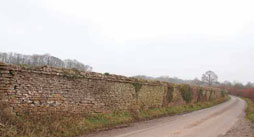
• The Dorset County Boundary Survey website
Durotriges

Landshire Lane

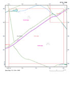
County boundary between Stalbridge, Dorset, and Henstridge, Somerset.

Wednesday 5 April 2017, - 10.00 for 10.30am

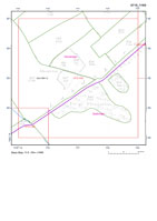
As previously noted we are taking as our focus this year those lengths of the boundary coincident with those 'registered' by Anglo-Saxon charters. Our first meeting will follow up that of June last year exploring the eastern length of Landshire Lane between Dorset and Somerset.With an interest expressed by the Somerset Archaeological and Natural History Society through the good offices of David Reid.

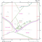
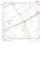
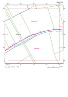
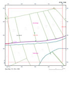
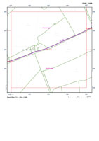
Back to the the Dorset/Somerset County Boundary east of the B357 between Stalbridge and Henstridge; we have the kind permission of the farmer Rob Selway to park up in the Wardshill farmyard on the south side of Landshire Lane, ST734192. Turn east onto Landshire Lane from the B357, driving over the former narrow railway bridge (the road edges of which have been recently 'white lined') and on the right-hand side there comes immediately into view the well-appointed Wardshill Farm house in a garden and just beyond this is the turning into the large farmyard - with a barn.

Landshire Lane
Cale Bridge, looking East from Somerset. The Dorset boundary is along the face of the wall around Stalbridge Park
E.Jervoise, The Ancient Bridges of the South of England,
The Architechtural Press, 1930
Landshire Lane, Stalbridge
Dorset Boundaries
Index for 1:2500 maps C.1886 of the Dorset (Stalbridge) and Somerset (Henstridge) boundary meered to Lanshire Lane

This is a meeting to further explore this distinctive length of the Dorset border across Blackmore; Landshire Lane may be identified as the Herepathe listed in the Henstridge Anglo-Saxon charter of AD 956 (Grundy 1935). Leader Katherine Barker.

Do join us all for what promises to be another interesting day in yet another very distinctive tract of country along the Dorset border. On a day almost the eleventh anniversary of the the launch of the DCB project by John Newbould and myself in the History Centre in 2006 bringing together those two 'arms' of the DNHAS, 'natural history and archaeology' [with historical geography].

Once again, do bring a sandwich for an informal picnic lunch - fingers crossed for the weather.

The Stalbridge Arms is, however, no longer open all day and will endeavour to locate somewhere not too far away for our sit-down 'wash-up' afterwards – will be back in touch when I have found somewhere!

Extract maps (400m x 400m) from OS County Series 1st Edition 1:2500 mapping circa 1886 with digitised feature and boundary overlay. Sheet reference based on full easting-northing 100m grid reference to the lower left internal corner
Sheet Description Boundary Dorset Parish Other Parish link KB size date
INDEX Landshire Lane  StalbridgeHenstridge, Somerset PDF
Yes, I agree with the licence
agreement. Right Click and
'Save Target As ...'
769 1886
3708-1179 Copse House Farm, Landshire Lane FW alongside roadPurse Caundle, StalbridgeHenstridge, Somerset PDF
Yes, I agree with the licence
agreement. Right Click and
'Save Target As ...'
171 1886
3712-1180 Landshire Lane FW alongside roadStalbridgeHenstridge, Somerset PDF
Yes, I agree with the licence
agreement. Right Click and
'Save Target As ...'
140 1886
3715-1183 Furge Plantation, Landshire Lane FW alongside roadStalbridgeHenstridge, Somerset PDF
Yes, I agree with the licence
agreement. Right Click and
'Save Target As ...'
209 1886
3719-1185 Nr Rabbit Warren, Landshire Lane FW alongside roadStalbridgeHenstridge, Somerset PDF
Yes, I agree with the licence
agreement. Right Click and
'Save Target As ...'
190 1886
3722-1188 Landshire Lane FW alongside roadStalbridgeHenstridge, Somerset PDF
Yes, I agree with the licence
agreement. Right Click and
'Save Target As ...'
179 1886
3726-1189 Roundhill Lodge, Landshire Lane FW, 6ft RH alongside roadStalbridgeHenstridge, Somerset PDF
Yes, I agree with the licence
agreement. Right Click and
'Save Target As ...'
286 1886
3730-1191 S&DJR rail bridge, Landshire Lane 6ft RH, 6ft Tk H alongside roadStalbridgeHenstridge, Somerset PDF
Yes, I agree with the licence
agreement. Right Click and
'Save Target As ...'
241 1886
3734-1192 Landshire Lane 6ft RH alongside roadStalbridgeHenstridge, Somerset PDF
Yes, I agree with the licence
agreement. Right Click and
'Save Target As ...'
195 1886
3738-1193 Landshire Bridge, Landshire Lane 6ft RH alongside roadStalbridgeHenstridge, Somerset PDF
Yes, I agree with the licence
agreement. Right Click and
'Save Target As ...'
208 1886
3742-1194 Rhodes House, Landshire Lane 6ft RH alongside roadStalbridgeHenstridge, Somerset PDF
Yes, I agree with the licence
agreement. Right Click and
'Save Target As ...'
185 1886
3746-1196 Landshire Lane 6ft RH alongside roadStalbridgeHenstridge, Somerset PDF
Yes, I agree with the licence
agreement. Right Click and
'Save Target As ...'
174 1886
3750-1197 Landshire Lane 6ft RH alongside roadStalbridgeHenstridge, Somerset PDF
Yes, I agree with the licence
agreement. Right Click and
'Save Target As ...'
181 1886
3754-1198 Landshire Lane 6ft RH alongside roadStalbridgeHenstridge, Somerset PDF
Yes, I agree with the licence
agreement. Right Click and
'Save Target As ...'
156 1886
3758-1199 Cale Bridge, Landshire Lane 6ft RH alongside road, CR (River Cale)Fifehead Magdalen, StalbridgeHenstridge, Somerset PDF
Yes, I agree with the licence
agreement. Right Click and
'Save Target As ...'
250 1886
- All of the above less index - Fifehead Magdalen,Purse Caundle, Stalbridge Henstridge, Somerset PDF
Yes, I agree with the licence
agreement. Right Click and
'Save Target As ...'
1,542 1886
Tithe 1840
Sheet DescriptionBoundary Dorset Parish Other Parish link KB size date
- Stalbridge, part of Stalbridge  PDF
Yes, I agree with the licence
agreement. Right Click and
'Save Target As ...'
291 1840
Ordnance Survey 1st Ed 1in mapping - draft 2in drawings
Sheet Description Dorset Parish Other Parish link KB size date
- Wincanton and Sherborne, part of StalbridgeHenstridge, Somerset PDF
Yes, I agree with the licence
agreement. Right Click and
'Save Target As ...'
21,283 C.1810
Stalbridge Park
Stalbridge Park wall
Stalbridge Park Wall
Dorset Life, 2012

The Old Stone Wall at Stalbridge

An article in Dorset Life magazine where Hilary Townsend explores the history behind the Park Wall. Five miles of ten feet high dry-laid coursed rubble with rounded capping and a projecting dripstone built c1760.

Sherborne map 1808
Sherborne map 2in drawing

Sherborne - 2in drawing, 1808

The copy in the British Library includes a red pecked line describes the border between the counties of Dorset and Somerset. Look at Wincanton to the north.

Stalbridge Arms
Stalbridge Arms

Stalbridge Arms

The Stalbridge Arms is no longer open all day and will locate somewhere, not too far away, for our sit-down 'wash-up' afterwards.