Landshire Lane
County boundary between Stalbridge, Dorset, and Henstridge, Somerset.Wednesday 6 April 2016, - 10.00 for 10.30am
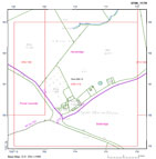
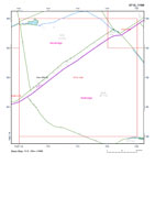
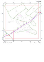
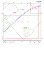
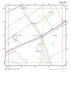
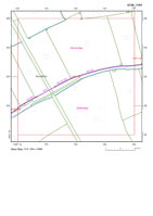
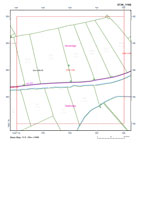
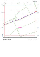
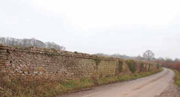
Much looking forward to our first field meeting of the year when we shall be exploring one of the most 'accessible' lengths of the county boundary along Landshire Lane across Blackmore. Following an almost straight course across a formerly unenclosed tract of Common its 'shire' designation in relation to its distinctive course suggest a deliberately 'made' length of the county boundary, a suggestion complemented by the fact that to this day it serves as a routeway - often quite a busy road.
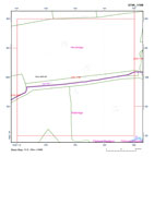
Further to marking the Dorset/Somerset border, Landshire Lane is also the boundary between the parish/manors of, respectively, Stalbridge and Henstridge, both of which present surviving Anglo-Saxon charters - the latter with bounds. We shall meet up in the concrete-surfaced pulling-in area on the north side of the Lane a few hundred yards east of Copse House [Farm], ST711181 [DT10 2SB]. Rosalyn Sclater of Frith Farm will kindly unlock the gateway for us.

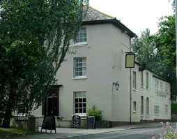
For our 'wash up' afterwards we will be meeting up at the Stalbridge Arms - in Stalbridge - which I am assured is open all day with plenty of room and lots of tables. (And will phone and re-confirm a little nearer the 6 April). Drive south on the A357 Henstridge-Stalbridge Road continuing on through Stalbridge village, through the narrow 'pinch point,' on past the entrance to Dykes Supermarket when a village green will come into view and the road divide. Take the left-hand fork and the Stalbridge Arms is located on the right-hand side of the road a few hundred yards further on. There is a car park behind the pub, turn in beside the further edge of what is quite a substantial building. (DT10 2NF)