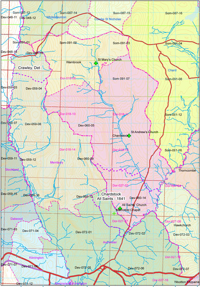
Chardstock
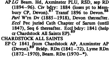
A parish of Deven, Dorset, and Somerset.Wednesday 2 August 2017, - 10.00 for 10.30am
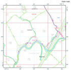
We will meet up in the car park behind The George Inn in the centre of Chardstock the address of which is ‘Chardstock, Axminster, Devon EX13 7BX’, ST 310044. I fell in step here with Ann West who was ‘on duty’ at the the time and will be very happy for us to leave our cars here from the time of our arrival and for us to hold our ‘wash up’ sit-down meeting here afterwards – to stay open a little longer than usual. The George Inn is signposted from the A 358 Axminster-Chard road, turning west at Tytherleigh.
From here we can take the public footpath north from the village school as far as Stockstyle and then east following the lane up onto the ridge which is crossed by the north/south course of the county boundary. It was during a recent reccy that I discovered that the prominent hilltop recorded along the boundary immediately east of Chardstock on the 1825 Greenwood map kindly forwarded to me by John Childs is not the site of the former episcopal beacon. This is/was located towards the south-western corner of the estate, but not named by Greenwood. Who did however, record its site by a small but distinctive symbol brought to my attention by an illustration in A History of the Parish of Chardstock – a monograph, a copy of which was on sale in the village shop. Beacon Hill is today accessed by a footpath leading up from a narrow lane above Fernham. There is a large yard here, permission to park our cars is from one Simon Duff – whose neighbour kindly gave me his phone number.
On arrival at The George Inn we can share thoughts as to how we might best organise the day given that the beacon is not sited along the boundary itself. But it will be interesting to find out as to why this particular hill was selected.
Our ‘wash up’ afterwards will let us all catch up with the news. It is a very ‘happening’ dcb period; this coming Wednesday, 19th, David Reid is kindly inviting members of SANHS to a meeting at the Pen Mill Hotel on the edge of Yeovil to share with them the dcb project (not least our recording methodology) and to turn thoughts to the day be held with them next year – over the border in Somerset. Progress is being made with our ‘listing’ of that length of the Up/Lyme Devon/Dorset boundary with the DCC Heritage Environment Record (almost certainly the first-ever length of a county boundary to be HER ‘registered’) and on Monday 24th July I shall be joining Luke Jenkins, Bournemouth University postgrad archaeologist to put a trial trench through a length of this distinctive boundary bank at the further end of Shire Lane also being the border of the episcopal estate granted to Sherborne at the end of the 7c. Full permission is given by Justin Bowles of Higher Knapps House whose garden is bounded by the bank on the Dorset side. Do please come and visit! Luke suggests that this exercise will almost certainly be completed by the end of the week. By the time of our field meeting on 2 August there will be something to report . . .